


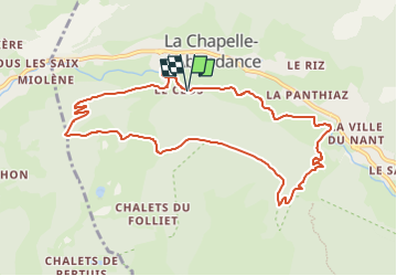

8.2 km | 21 km-effort


User


FREE GPS app for hiking
 SityTrail
IGN / Geographical institutes
SityTrail World
The world is yours!
Trail Walking of 10.1 km to be discovered at Auvergne-Rhône-Alpes, Upper Savoy, La Chapelle-d'Abondance. This trail is proposed by Derrendinger.
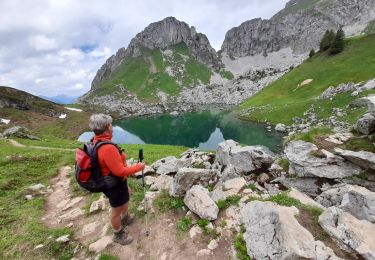
Balade sympa avec une montée un peu raide

Walking

Walking

Walking

Walking

Snowshoes

Snowshoes

Walking

Walking
Walking